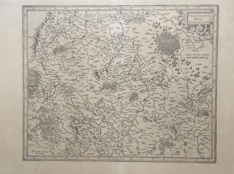
MERCATORE Gerard (mapmaker) (1512 - 1594)
No. 15917
Description
(1512 - 1594)
Map of the Rhine Palatinate
Etching
Technical specifications
Impression on laid paper, republished in 1606 by Jodocus Hondius & Cornelis Claesz in Amsterdam in the book L'Atlas.
Sheet: 380 x 512 mm
Plate: 340 x 420 mm
Reference: A print is preserved in the Bibliothèque nationale de France.
Condition: vertical fold in the middle, stains in the lower margin.
165 €