Sold
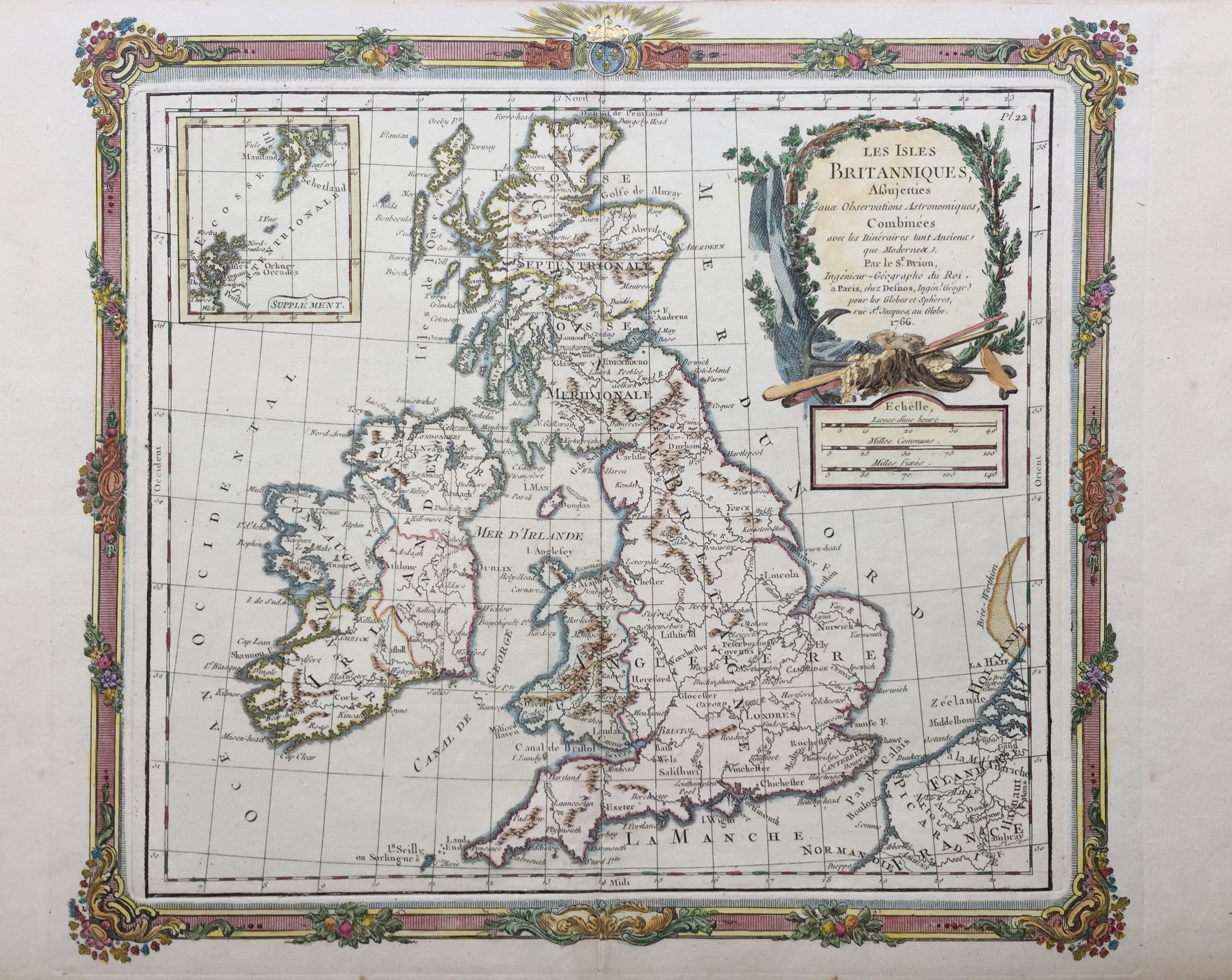
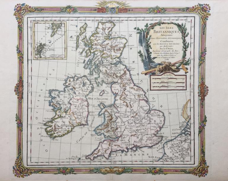
BRION DE LA TOUR Louis (circa�1743 - 1803)
No. 16353
Description
(circa 1743 - 1803)
Map of the United Kingdom
Handcoloured etching
Technical specifications
1766
Impression on laid paper, plate from the book, Catalogue raisonné des cartes qui composent l'Atlas général, civil, ecclésiastique & militaire, méthodique & élémentaire de géographie moderne..., published by Desnos, in Paris.
Sheet: 289 x 395 mm
Image: 280 x 316 mm
Condition: vertical fold in the center.
This work has been sold. Discover other similar pieces in our catalog.