Index of the artists
JEAN Pierre (publisher)
FICHE 11346
(1754 - 1829)
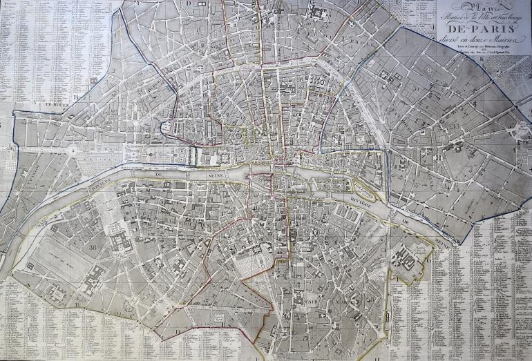
Le plan routier de la ville et des faubourgs de Paris, divisé en douze mairies
1832
Etching with handcoloured lines
Map corrected by Hérisson geographer, published by Jean, Paris. With the streets.
Plate: 590 x 860 mm.
Condition: small margins, impression laid on strong paper, some stains, slight soiling and small restored tears in the edges.
600 €